|
| Buoy 071 Harvest
Longitude = 120.789W Latitude = 34.458N
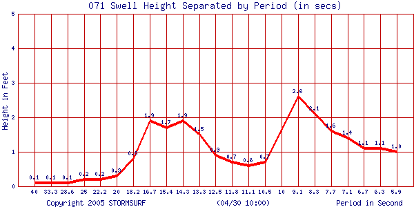
FAQs | | Current Swell & Surf Analysis | | Buoy 071 | | 08:22:00 (GMT) on 06/15 | | Sea Height: | 7.4 ft | | Primary Swell Height: | 4.1 ft | | Primary Swell Period: | 9.1 secs | | Primary Swell Direction: | 301 degrees | | Surf Height: | 3.0-3.7 ft |
Date
(Month - Day) | Time
(GMT) | Combined Sea Height
[>5 secs]
(ft) | Primary Swell | Secondary Swell | Tertiary Swell | Estimated Surf Height (ft) | Primary Swell Period
(secs) | Height
(ft) | Period
(secs) | Diection
(deg) | Height
(ft) | Period
(secs) | Direction
(deg) | Height
(ft) | Period
(secs) | Direction
(deg) |
| 06/15 | 08:22:00 | 7.4 | 4.1 | 9.1 | 301 | 2.1 | 16.3 | 192 | 1.5 | 20.3 | 220 | 3.0 -3.7 | 9.1 | | 06/15 | 07:21:00 | 7.4 | 3.7 | 9.2 | 300 | 2.0 | 15.1 | 196 | 1.6 | 18.4 | 229 | 2.8 -3.5 | 9.2 | | 06/15 | 06:21:00 | 7.6 | 2.3 | 16.6 | 198 | 1.8 | 20.3 | 206 | 4.0 | 9.2 | 301 | 3.1 -3.8 | 16.6 | | 06/15 | 05:21:00 | 7.4 | 2.5 | 16.4 | 184 | 2.0 | 20.2 | 176 | 4.1 | 9.3 | 298 | 3.3 -4.1 | 16.4 | | 06/15 | 04:21:00 | 7.6 | 4.2 | 9.2 | 303 | 2.1 | 16.5 | 185 | 1.6 | 19.6 | 172 | 3.1 -3.9 | 9.2 | | 06/15 | 03:21:00 | 7.3 | 4.1 | 9.2 | 303 | 2.1 | 16.4 | 191 | 1.6 | 19.4 | 204 | 3.0 -3.8 | 9.2 | | 06/15 | 02:21:00 | 7.4 | 2.4 | 18.4 | 189 | 4.1 | 9.2 | 307 | 1.8 | 14.1 | 200 | 3.5 -4.3 | 18.4 | | 06/15 | 01:20:00 | 7.5 | 4.4 | 9.3 | 308 | 1.8 | 16.5 | 173 | 1.4 | 20.7 | 183 | 3.2 -4.1 | 9.3 | | 06/15 | 00:21:00 | 7.1 | 4.1 | 9.4 | 310 | 2.1 | 16.3 | 184 | 1.5 | 19.5 | 198 | 3.1 -3.9 | 9.4 | | 06/14 | 23:21:00 | 7.8 | 2.3 | 20.2 | 189 | 2.6 | 17.1 | 184 | 4.1 | 9.4 | 312 | 3.7 -4.7 | 20.2 | | 06/14 | 22:21:00 | 6.8 | 4.0 | 9.3 | 310 | 1.9 | 17.4 | 189 | 1.5 | 20.6 | 199 | 3.0 -3.7 | 9.3 | | 06/14 | 21:21:00 | 7.5 | 3.4 | 17.9 | 184 | 2.1 | 22.0 | 188 | 4.3 | 9.3 | 313 | 4.8 -6.0 | 17.9 | | 06/14 | 20:21:00 | 7.5 | 4.1 | 9.2 | 310 | 2.2 | 16.4 | 190 | 1.5 | 20.7 | 201 | 3.0 -3.8 | 9.2 | | 06/14 | 19:21:00 | 7.6 | 4.9 | 9.2 | 309 | 2.2 | 16.1 | 191 | 2.4 | 12.2 | 251 | 3.6 -4.5 | 9.2 | | 06/14 | 18:21:00 | 7.9 | 5.2 | 9.2 | 311 | 1.9 | 15.9 | 199 | 1.1 | 19.9 | 219 | 3.8 -4.8 | 9.2 | | 06/14 | 17:21:00 | 8.4 | 5.6 | 9.3 | 307 | 2.5 | 17.8 | 189 | 1.8 | 22.2 | 202 | 4.2 -5.2 | 9.3 | | 06/14 | 16:21:00 | 8.1 | 5.0 | 9.2 | 307 | 1.8 | 17.7 | 190 | 1.3 | 21.4 | 206 | 3.7 -4.6 | 9.2 | | 06/14 | 15:21:00 | 7.7 | 4.8 | 9.3 | 307 | 1.9 | 16.1 | 187 | 2.0 | 13.1 | 226 | 3.6 -4.5 | 9.3 | | 06/14 | 14:22:00 | 7.6 | 4.6 | 9.3 | 312 | 2.2 | 16.2 | 192 | 2.3 | 13.1 | 238 | 3.4 -4.2 | 9.3 | | 06/14 | 13:22:00 | 7.7 | 4.5 | 9.2 | 318 | 1.8 | 22.5 | 195 | 2.2 | 17.9 | 186 | 3.4 -4.2 | 9.2 | | 06/14 | 12:21:00 | 7.8 | 4.8 | 9.2 | 315 | 1.9 | 17.5 | 202 | 1.3 | 20.5 | 209 | 3.5 -4.4 | 9.2 | | 06/14 | 11:21:00 | 7.2 | 4.0 | 9.2 | 314 | 1.8 | 16.9 | 213 | 2.1 | 13.3 | 218 | 3.0 -3.7 | 9.2 | | 06/14 | 10:21:00 | 6.2 | 2.0 | 17.6 | 186 | 1.3 | 22.6 | 185 | 3.1 | 9.3 | 315 | 2.8 -3.4 | 17.6 | | 06/14 | 09:21:00 | 6.4 | 3.8 | 8.3 | 312 | 1.8 | 17.5 | 191 | 1.9 | 13.9 | 193 | 2.5 -3.2 | 8.3 |
Surf Height Scale| Size Scale (ft) | | >1 | 1-2 | 2-3 | 3-4 | 4-5 | 5-6 | 6-7 | 7-8 | 8-9 | 9-10 | 10-11 | 11-12 | 12-13 | 13-14 | 14-15 | 15-20 | 20-25 | 25-30 | 30-35 | 35-40 | 40-45 | 45+ |
Swell Period Scal| CDIP Period Scale (secs) | | 6.3 | 6.7 | 7.1 | 7.7 | 8.3 | 9.1 | 10 | 10.5 | 11.1 | 11.8 | 12.5 | 13.3 | 14.3 | 15.4 | 16.7 | 18.2 | 20 | 22.2 | 25 | 28.6 | 33.3 | 40 |
| 000209775 ___0.040908 | |
|