|
| Buoy 036 Grays Harbor
Longitude = 124.245W Latitude = 46.857N
FAQs | | Current Swell & Surf Analysis | | Buoy 036 | | 19:20:00 (GMT) on 08/16 | | Sea Height: | 8.5 ft | | Primary Swell Height: | 6.1 ft | | Primary Swell Period: | 10.3 secs | | Primary Swell Direction: | 279 degrees | | Surf Height: | 5.0-6.3 ft |
Date
(Month - Day) | Time
(GMT) | Combined Sea Height
[>5 secs]
(ft) | Primary Swell | Secondary Swell | Tertiary Swell | Estimated Surf Height (ft) | Primary Swell Period
(secs) | Height
(ft) | Period
(secs) | Diection
(deg) | Height
(ft) | Period
(secs) | Direction
(deg) | Height
(ft) | Period
(secs) | Direction
(deg) |
| 08/16 | 19:20:00 | 8.5 | 6.1 | 10.3 | 279 | 3.9 | 7.2 | 278 | 1.9 | 14.2 | 239 | 5.0 -6.3 | 10.3 | | 08/16 | 18:20:00 | 7.9 | 5.2 | 10.3 | 282 | 2.5 | 13.4 | 260 | 3.3 | 7.2 | 278 | 4.3 -5.3 | 10.3 | | 08/16 | 17:20:00 | 7.7 | 5.0 | 10.4 | 280 | 1.9 | 14.2 | 249 | 3.5 | 7.2 | 274 | 4.2 -5.2 | 10.4 | | 08/16 | 16:20:00 | 7.5 | 5.3 | 9.3 | 281 | 2.3 | 12.5 | 263 | 0.8 | 16.4 | 240 | 3.9 -4.9 | 9.3 | | 08/16 | 15:20:00 | 7.2 | 4.9 | 9.2 | 279 | 1.7 | 13.7 | 248 | 0.9 | 17.2 | 238 | 3.6 -4.5 | 9.2 | | 08/16 | 14:20:00 | 6.4 | 4.4 | 8.3 | 271 | 1.8 | 12.1 | 238 | 0.9 | 16.2 | 243 | 3.0 -3.7 | 8.3 | | 08/16 | 13:20:00 | 5.7 | 3.9 | 8.4 | 275 | 1.3 | 14.8 | 235 | 0.5 | 18.9 | 235 | 2.6 -3.2 | 8.4 | | 08/16 | 12:20:00 | 4.9 | 2.8 | 8.3 | 270 | 1.3 | 13.9 | 222 | 0.8 | 17.4 | 236 | 1.9 -2.3 | 8.3 | | 08/16 | 11:20:00 | 4.9 | 3.0 | 8.3 | 275 | 1.5 | 15.2 | 228 | 1.2 | 11.5 | 239 | 2.0 -2.5 | 8.3 | | 08/16 | 10:20:00 | 4.6 | 3.0 | 7.7 | 269 | 1.3 | 14.6 | 224 | 0.5 | 18.8 | 207 | 1.8 -2.3 | 7.7 | | 08/16 | 09:21:00 | 5.1 | 3.1 | 7.7 | 270 | 1.4 | 14.0 | 228 | 0.7 | 17.4 | 229 | 1.9 -2.4 | 7.7 | | 08/16 | 08:20:00 | 4.9 | 3.0 | 8.3 | 275 | 1.4 | 14.4 | 226 | 0.4 | 19.5 | 235 | 2.0 -2.5 | 8.3 | | 08/16 | 07:21:00 | 5.1 | 3.6 | 7.2 | 254 | 1.3 | 14.7 | 220 | 1.1 | 11.6 | 230 | 2.1 -2.6 | 7.2 | | 08/16 | 06:21:00 | 5.9 | 4.2 | 7.1 | 247 | 1.3 | 14.5 | 230 | 1.3 | 10.2 | 263 | 2.4 -3.0 | 7.1 | | 08/16 | 05:21:00 | 6.3 | 4.1 | 7.2 | 236 | 1.5 | 15.2 | 229 | 1.1 | 11.6 | 235 | 2.4 -2.9 | 7.2 | | 08/16 | 04:21:00 | 6.3 | 4.1 | 7.2 | 236 | 1.5 | 15.2 | 229 | 1.1 | 11.6 | 235 | 2.4 -2.9 | 7.2 | | 08/16 | 03:21:00 | 6.3 | 3.5 | 6.7 | 223 | 1.4 | 15.2 | 223 | 1.1 | 11.6 | 240 | 1.9 -2.4 | 6.7 | | 08/16 | 02:21:00 | 6.8 | 4.3 | 6.7 | 215 | 1.8 | 14.6 | 222 | 0.7 | 19.1 | 209 | 2.3 -2.9 | 6.7 | | 08/16 | 01:21:00 | 7.0 | 4.6 | 6.3 | 206 | 1.3 | 14.5 | 230 | 0.7 | 17.8 | 226 | 2.3 -2.9 | 6.3 | | 08/16 | 00:20:00 | 7.3 | 4.5 | 6.6 | 203 | 1.6 | 14.6 | 215 | 1.0 | 17.7 | 204 | 2.4 -3.0 | 6.6 | | 08/15 | 23:20:00 | 7.7 | 5.2 | 6.3 | 190 | 1.5 | 14.8 | 218 | 0.6 | 19.7 | 198 | 2.6 -3.3 | 6.3 | | 08/15 | 22:21:00 | 7.4 | 4.7 | 6.2 | 191 | 1.4 | 14.7 | 224 | 0.6 | 19.6 | 212 | 2.3 -2.9 | 6.2 | | 08/15 | 21:20:00 | 7.4 | 4.7 | 6.2 | 192 | 1.6 | 14.7 | 226 | 0.6 | 19.5 | 210 | 2.3 -2.9 | 6.2 | | 08/15 | 20:20:00 | 7.2 | 1.7 | 14.7 | 223 | 3.5 | 6.2 | 210 | 0.7 | 19.6 | 204 | 2.0 -2.5 | 14.7 |
Surf Height Scale| Size Scale (ft) | | >1 | 1-2 | 2-3 | 3-4 | 4-5 | 5-6 | 6-7 | 7-8 | 8-9 | 9-10 | 10-11 | 11-12 | 12-13 | 13-14 | 14-15 | 15-20 | 20-25 | 25-30 | 30-35 | 35-40 | 40-45 | 45+ |
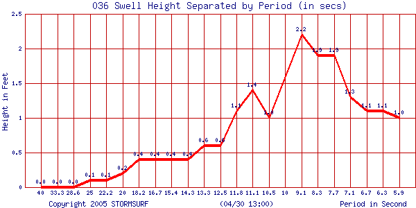
Swell Period Scal| CDIP Period Scale (secs) | | 6.3 | 6.7 | 7.1 | 7.7 | 8.3 | 9.1 | 10 | 10.5 | 11.1 | 11.8 | 12.5 | 13.3 | 14.3 | 15.4 | 16.7 | 18.2 | 20 | 22.2 | 25 | 28.6 | 33.3 | 40 |
| 000036909 ___0.02667 | |
|